011 Argentina · Buenos Aires
Country: Argentina
City: Buenos Aires
Scene code: 011 — country 01, city 1
Location and geography
Buenos Aires is Argentina’s capital, on the western shore of the Río de la Plata estuary in eastern South America. Uruguay lies across the water. The city’s location connects it to river routes inland and shipping routes toward the Atlantic, helping explain its development as a port and commercial center.
The autonomous city is distinct from the surrounding Province of Buenos Aires. Its wider metropolitan area extends beyond the city boundary. Broad avenues and dense neighborhoods contrast with riverside spaces and the parks of Palermo. Seasons follow the Southern Hemisphere calendar: summer falls around December–February and winter around June–August.
Culture and everyday life
People from Buenos Aires are often called porteños, meaning people of the port. Immigration helped shape the city’s architecture, language, music, and neighborhood identities. Spanish is the main language, with the local Rioplatense variety giving conversation a distinctive sound.
Tango is a key cultural thread. It developed among working-class communities around the Río de la Plata, in both Buenos Aires and Montevideo. Its expressive music and partner dancing remain closely associated with the city. A milonga can refer to a social gathering where people dance tango. Read about tango’s origins.
Food and conversation are another way to understand Buenos Aires. Asado brings people together around grilled food, while mate, a yerba-mate infusion, is part of a shared social ritual. Neighborhood cafés, pizzerias, and traditional restaurants are important meeting places. Theater, books, and visual art add to the city’s cultural life. Official tourism: food and cultural experiences.
A short history
- 1536: Pedro de Mendoza established a Spanish settlement in territory inhabited by Indigenous communities; it was later abandoned.
- 1580: Juan de Garay established the settlement that became the lasting city.
- 1776: Buenos Aires became the capital of the Viceroyalty of the Río de la Plata.
- 1810: The May Revolution replaced the viceroy with a local governing junta, an important step toward independence.
- 1880: Buenos Aires became Argentina’s federal capital.
Port trade and immigration later transformed its neighborhoods and streets. These layers help explain the contrast between monumental civic architecture and colorful former port districts. Official tourism: city history.
Famous sights in this scene
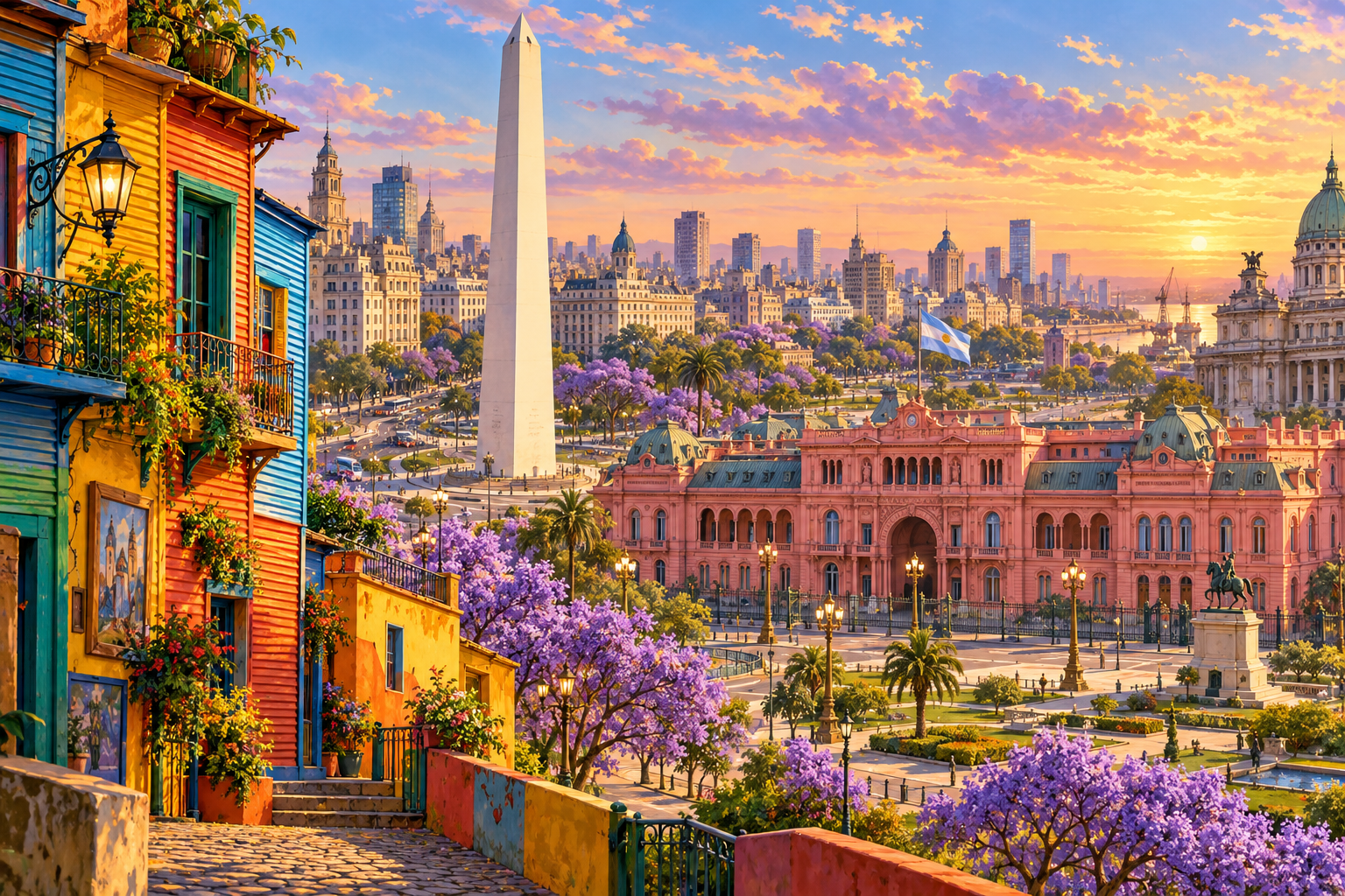
- The Obelisk (El Obelisco): The tall white monument is one of Buenos Aires’ best-known symbols. It was inaugurated in 1936 to commemorate the 400th anniversary of the city’s first foundation.
- Casa Rosada: The pink governmental palace overlooking Plaza de Mayo is recognizable by its elaborate facade and balconies.
- Caminito, La Boca: Brightly painted houses recall the open-air street museum in the city’s historic port neighborhood.
More sightseeing to explore
The illustration highlights three landmarks, but other places reveal different sides of the city:
- Plaza de Mayo: Explore the historic civic square beside Casa Rosada and connect the city’s buildings with its political history.
- Teatro Colón: Discover the city’s opera and classical-music heritage through its grand theater and architectural interior.
- San Telmo: Historic streets, antiques, and tango traditions make this district a useful introduction to neighborhood culture.
- Recoleta Cemetery: Monumental tombs and mausoleums make the cemetery a place to study architecture and the stories of notable Argentines.
- Palermo parks: Green spaces offer a contrast to the busy center and help show how parks form part of everyday urban life.
Official tourism: attractions · Official tourism: cultural and neighborhood guide.
The scene
Golden evening light warms the pink palace and colorful houses. The Obelisk rises above the broad avenue, while purple jacaranda blossoms frame the foreground. Find the three featured sights, then match their names to the image.
This AI-generated artistic panorama brings together landmarks from separate districts. Their arrangement and distances are illustrative, rather than a geographically exact view.
Geography clue
“You are searching for a South American capital with a pink governmental palace, a famous white obelisk, and a colorful street called Caminito.”
Answer: Buenos Aires, Argentina.
Sources
Image creation
Created with the built-in image generation tool. Prompt: A unified landscape, hand-painted travel-game panorama of Buenos Aires featuring the white Obelisk, pink Casa Rosada, and colorful La Boca/Caminito houses; warm golden-hour light, purple jacaranda trees, recognizable architecture, no captions or watermarks. Artistically combine landmarks from different districts.